
A Very Helpful Sign
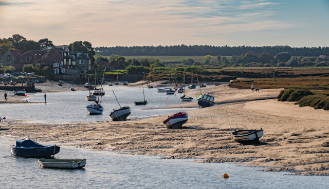
H and I were blessed with perfect autumn weather on our walk today, clear blue sky and sunshine. We walked about 7 miles, a circular route starting at Burnham Overy Staithe (main photo taken in the hazy late afternoon sunshine), the half way point being Holkham Gap, where we had our lunch. Lots of variety of habitat including dunes, beach, coastal path and pine woods.
I was quite taken by the Norfolk Coastal Path sign (see extra) which not only points the way to Holkam Gap and Burnham Overy Staith but also indicates the direction of 'The Hero' public house and restaurant and includes their phone number (presumably so you can phone ahead to book a table). I've never seen a commercial property mentioned on an official NT sign post before. A joint venture perhaps?
In modern times a distinction is often made between the two settlements of Burnham Overy Town, the original village adjacent to the medieval parish church and now reduced to a handful of houses, and Burnham Overy Staithe, a rather larger hamlet about 1-mile (1.6 km) away and next to the creek-side harbour.
The villages name means 'Homestead/village on the River Burn' or perhaps, 'hemmed-in land on the River Burn'. 'Overy', meaning 'Over the river', was added to distinguish it from the other Burnhams in Norfolk.

Comments
Sign in or get an account to comment.


