
Dolomites!
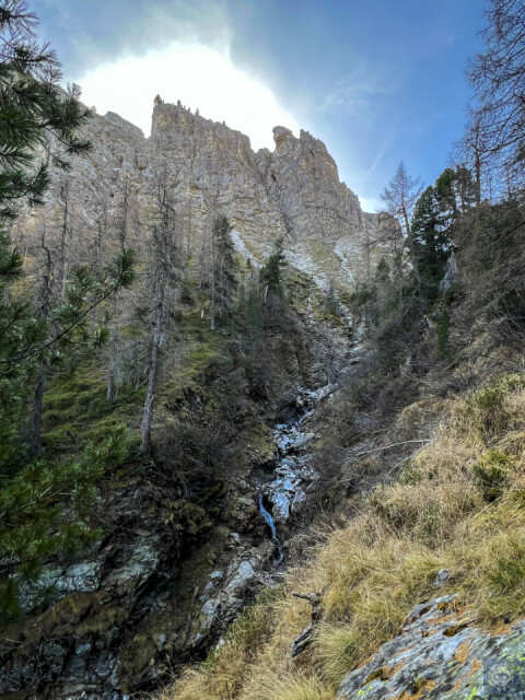
Encouraged by our recent off-track routes, we tackled a longer valley walk today, with a dubious looking 'dotted line' ascent marked on the map at the end. 1000' from car to this point, over a few kms was no problem, but from here on up for another 1000' it was a case of working a very vague route up steep ground, not knowing if a bluff or bad-step would halt our progress. Fortunately the bluff we did find, was scalable and we got to the limestone plateau at the top and even had enough left for an extra 1000' to scale another lesser climbed peak - Plattnock (2316m). Back down the same way.
Glorious cool woods in the morning, kept us in the shade until the end, with superb cliffs that reminded us of walking in the Italian Dolomites. (Most of the rock here is Schist, but there are some patches and bands of dolomitised limestone in places).
The navigation here was interesting. We had two paper maps that said quite different things, and two online maps that almost agreed with them. Google places a road up this valley that has never, and could never exist! Anyway, the new map was so inaccurate as to be completely useless. The old map showed where the old alm trail was and hinted as to a possible line of ascent, but there was almost nothing on the ground, although as we found - it was possible.
Comments
Sign in or get an account to comment.


