
Even more water
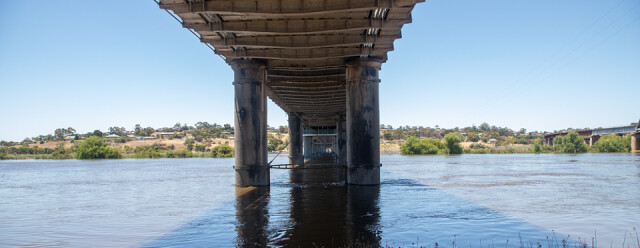
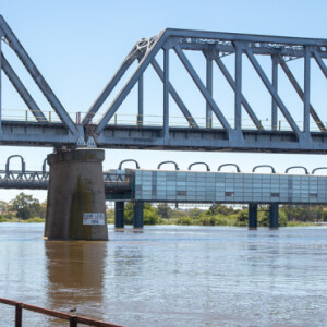
Murray Bridge is higher upstream than Tailem Bend (yesterday). We are under the original road bridge to Melbourne (built in 1857). Alongside side (you can see a glimpse on the far right of the image) is the rail bridge, built in the mid-1920's.
This was built to take the pressure off the dual use original bridge because it was felt that rail and road traffic was too much for the older structure. At this time there would have been around 15 trains a day, carrying goods from Murray Bridge to Adelaide (in one direction) and Melbourne (in the other). The River itself was a super highway for paddle steamers and barges bringing produce down from higher up the river.
I hope you are reading all of this - there will be a quiz later :)
These days there is a third bridge at Swanport, (built in 1979) which carried all the road traffic, and the original bridge (built in 1857 - remember) is used for local traffic, and history buffs only.
There was a move to demolish the original bridge, because it was crumbling under increased traffic - must be all those history buffs - but there was an outcry that they are restoring it instead.
In extras there is a plaque showing the river flood level in 1956 - I think we will reach that level when the river peaks in a few days.
The river is flowing at a great pace, and I certainly would not wish to get caught up in it. It's not all bad news for Murray Bridge though. The place was heaving with tourists, and the locals are clearly making a mint of money. Not so the farmers who are having to cope with vast areas of flood plains being flooded.
There will be more on Murray Bridge in coming days. It's a fascinating place, quite apart from the floods.
Comments
Sign in or get an account to comment.


