
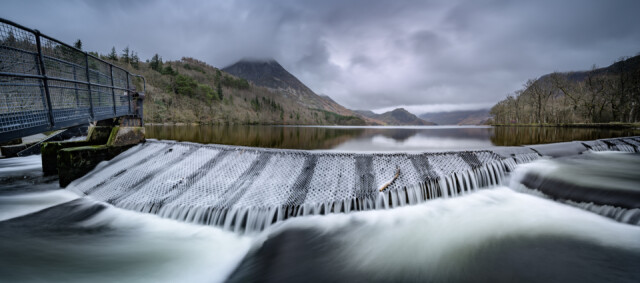
Crummock weir
Had a dreadful night's sleep - the wind constantly buffeted the patio doors in the bedroom - we had gusts of over 50 mph.
After I dropped (a very tired) Debs off at work, I drove over to Crummock water in the hope of catching water spouts lifted up by the wind. You can see by the surface of the lake behind the weir, that the chance of water spouts was non-existent. It was flat calm without a breath of wind. While I was there I got chatting to a chap who lives just up the road from the lake. He told me that United Utilities no longer need Crummock as a water supply, so are planning to remove the weir in the next three years or so. This will result in the water levels being (typically) about 5 - 6 feet down on current levels, but will allow the lake to hold current levels in times of flood. It will - of course - create great change in the appearance of Crummock Water, with the Islands at the far end becoming part of the shore, the boathouse ending up 5 feet above water level, and all the farmers sheep fences needing to be extended.
There's a lot of planning meetings to go yet, so there will be plenty of objection to it as well.
Thought a post of the weir was appropriate. This is a 5-shot pano, taken with a little stopper and an ND grad filter.
Comments
Sign in or get an account to comment.


