
GEO BLIP
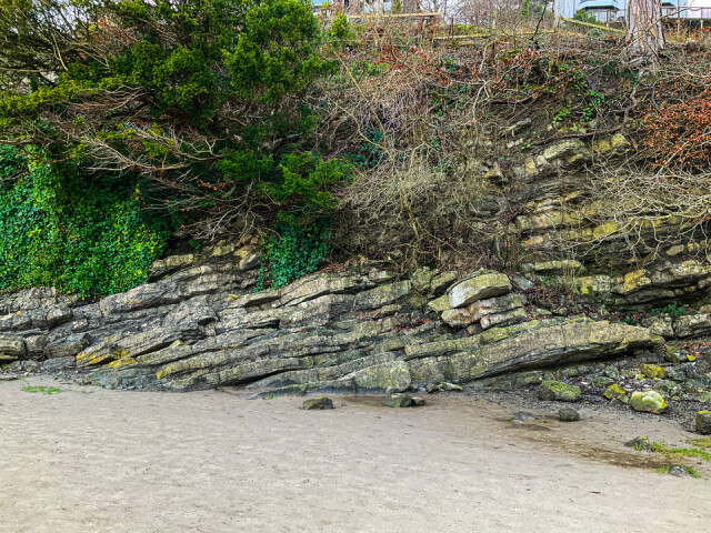
Think back 350 million years if you can.
At that time Arnside was situated about 5 degrees south of the
Equator.
It was in warm, shallow seas. Those seas also housed an unimaginable number of creatures with shells. When they died their shells fell to the ocean floor and in time were compressed to form carboniferous limestone.
That Limestone now forms the bedrock of the Arnside and Silverdale area including our beloved Arnside Knott. In this blip you are looking at layers of the variety known as Dalton. Pressures over time moved much of it from the horizontal to slopes.
Here you can see that the layers go on down under the sand of the beach. In fact out in the estuary the bedrock is as much as 60 metres below the surface and is covered by glacial till and gravel. This made a real challenge for the engineers who built the railway viaduct in the 1850s.
I could go on. But better if I say that if you are coming to Arnside and you are interested in Geology I strongly recommend the Arnside Geotrail booklet. It can be bought at RSPB Leighton Moss or on the website of the ArnsideSilverdaleAONB LandscapeTrust
Comments
Sign in or get an account to comment.


