
Tamara Way
Today I crossed the River Tamar by ferry from Plymouth to Cremyll, then followed the Tamara Way to Torpoint where I crossed the Tamar again on the Torpoint Ferry (actually a floating Bridge).
The Tamara Way is an 87 mile coast-to-coast trail which begins at Cremyll at the mouth of the River Tamar and ends at Marsland Mouth on the northern boarder of Devon and Cornwall.
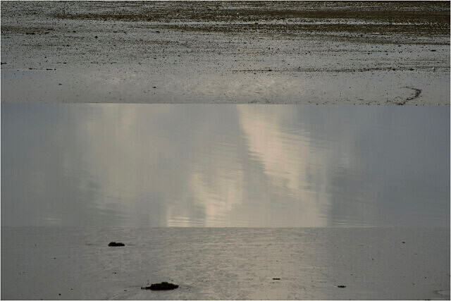
The first stretch which I walked today is around seven to eight miles. Despite it's proximity to Plymouth and the naval dockyards there is some wonderful scenery, varied wildlife and many points of interest. Within the first mile there is an oblisk, some interesting buildings which formed part of a World War 2 fuel depot and a stone tower which was once a windmill. My blip shows the reflection of the clouds in Millbrook Lake, which is one of the many tributaries of the Tamar. Although I was spoilt for blip photo opprtunities, I liked this simple image as to me it seemed to capture the essence of the river's tidal creeks.
Comments
Sign in or get an account to comment.


