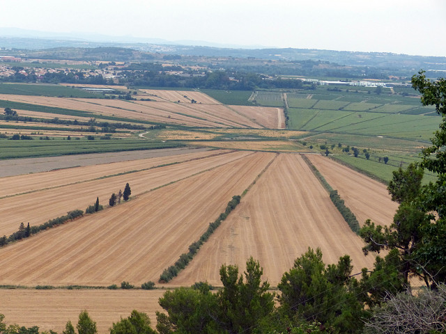
Etang de Montady
Originally a freshwater lagoon, supposedly created by the Visigoths, the land was drained in the 13th Century by creating a series of radial water courses that eventually lead into an underground watercourse.
The wedge shaped pieces of land that were formed in this way can still be clearly seen from the nearby hilltop (Oppidum d'Enserune) which was once the site of a Gallic then Roman settlement close to the Via Domitia.
The location map clearly shows the water channels draining the etang.
Comments
Sign in or get an account to comment.


