What’s the point ?
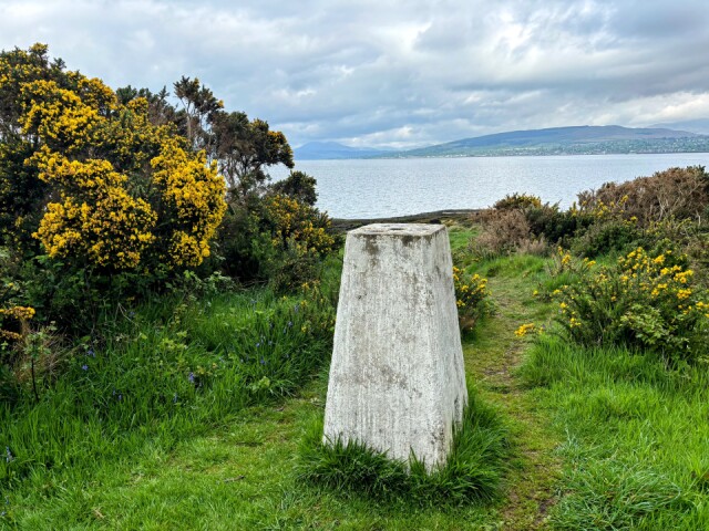
This triangulation point on Ardmore Point stands at only 8 metres above sea level. Not a record though, the lowest is at Little Ouse in Cambridgeshire at -0.533 metre below sea level, with the highest being on Ben Nevis.
There are 6,500 of them spread all over the UK, mainly at the highest points, and were used as survey fixing stations from 1936 until the mid sixties, when new technology came in. There’s even a trigbagging interest now with folk walk to them and ticking it off. I’ve probably done hundreds, so it’s 5000 plus to go, don’t think I’ll bother.
Comments
Sign in or get an account to comment.


