
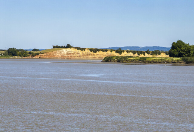
Westbury Garden Cliff by the river Severn
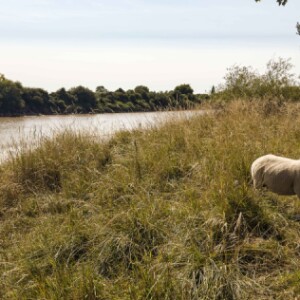
Woodpeckers rang me to arrange to be picked up from the campsite near Bollow on the Forest of Dean side of the river Severn. I got there after 2pm and it was delightfully warm so she suggested a short walk from the campsite in the orchard through a field to the West Bank of the river Severn. We strolled along the bank to a place here she had found people, swimming yesterday, but today there were only sheep for company. The tide was coming in quickly and covering the sand and mud banks so we didn’t wander down to the ‘beach’.
Instead of driving straight home we drove about four miles to Westbury o Severn and then on a further mile to the White Hart pub on the bank of the river. We sat on their terrace and enjoyed the scene with the incoming tide rapidly covering the sandbanks. Here was the beginning of the Severn estuary where the tide washes widely across the flood plain. If you see my Blip from Friday, two days ago, you can see this spot on the left of the picture, as the meander starts to turn to the right. The cliff is just beyond the apex of the bend.
I’ve added a picture of a sheep on the bank of the river near the campsite, which shows how much narrower the river is just a couple of miles upstream.
Taken from Gloucestershire Naturalist's Society website:
Garden Cliff is one manifestation of the mudstone beds that are evident throughout the Severn Valley and exposed at Wainlodes in the north, Garden Cliff, Newnham, Bullo and Box Wood (Awre) in the west, Hock Cliff in the east and Aust Cliffs (adjacent to the Severn Bridge) in the south. Sometimes referred to as Keuper Marls, the mudstone (which is so friable and soft as to barely warrant the title “rock”) was formed in the upper Triassic some 200+ million years ago and marks the boundary with the later Jurassic period. With its stripes of green-grey and red strata, Garden Cliff stands out as a visible landmark in the alluvial plain. The beds were formed in arid, semi-desert conditions before being overlaid by brackish and marine water borne sediments of the early Jurassic.
At the eastern end of the cliff the strata dips down so that the overlying beds of shale, sandstone and limestone are visible and within reach. The foreshore at this point is littered with slabs of fossilised beach fragments, the ripples clearly visible and diagnostically marine formed as evidenced by their profile.
Comments
Sign in or get an account to comment.


