
Bells Line
The Upper Blue Mountains roads that were closed during the height of the recent fire crisis are now re-opened. I have now driven into the Megalong, Kanimbla and Hartley Valleys. I have now driven to the principal vantage points overlooking the Jamison and Grose Valleys. Put all of these places together and you have what most people think of as "The Blue Mountains".
At all of the places mentioned above it is very difficult to see or find fire damage. Except for the Hartley and Grose, THERE simply IS NO damage according to all reports. In the Hartley and Grose there most definitely IS damage but it is not visible to tourists, where they normally go. At least I couldn't see it and I know where to look. Very obvious damage is to be found along some access roads. Some of it is from backburn and some of it is from the uncontrolled fire itself. It is easy to find isolated intact properties right up to which the fire ran free. Here and there you can find properties that were lost ... despite all efforts.
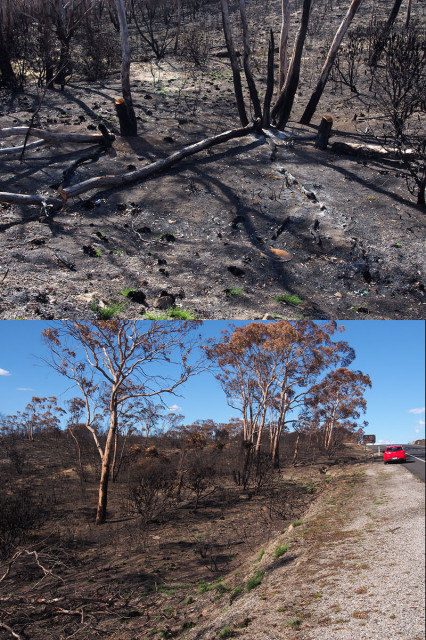
The two pictures above were shot from the Bells Line of Road. The territory I have described is to the south of here. What we can actually see here is the beginnings of 50,000 burned out hectares of natural bushland to the NORTH of Bells Line, primarily in the Lithgow and Hawkesbury precincts. It seems to go on and on like this across many distant ridges.
Having said all of the above, I must emphasize that I make no comment at all about the Winmalee/Springwood fire zone in the LOWER Blue Mountains. I have not had personal access to that area as yet.
294
views
- 5
- 0
- Olympus E-M5
- f/7.1
- 19mm
- 200
Comments
Sign in or get an account to comment.


