Kimmeridge revisited: crumbling lansdscape
Better weather, a hint of sunshine, clearer image, otherwise similar to the photo taken on 10th January. This time I intended to climb the cliff path up to the tower, but found a notice stating that the path was closed by a landslip.
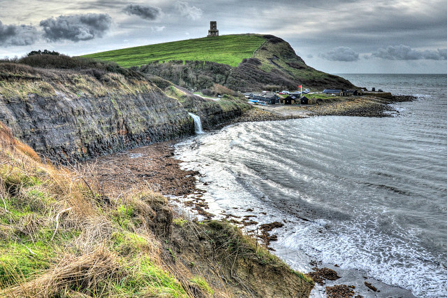
Purbeck's cliffs are potentially dangerous, and perhaps that is part of their charm. You can see in this photo a clayey chunk of the field just a few feet ahead of me, almost ready to slip into the bay. A little above the red flag further back you will see a dark, curved scar in the grass: this is the landslip which has affected part of the coastal path. In my original photo, two walkers are discernable in the lower part of the path, perhaps they have decided to investigate.
And a succession of ridges can be seen in the grassy field just below Clavell's Tower. Here again the earth is straining to move downhill, but inland rather than into the sea.
Why the red flag?
Kimmeridge is adjacent to the Lulworth Army Ranges. When the ranges are in use, be it for tank or artillery practice, a large area of sea (covering up to six nautical miles offshore) becomes a prohibited area. The red flag is to indicate danger, specifically the danger of overshooting.
According to the plan exhibited in the harbour, it is possible during such practice to sail a boat out of Kimmeridge Harbour, but you would then have to go east to avoid infringing the prohibition.
This morning I only heard the sound of machine-gun fire.
HDR, yet again! I used HDR to help bring out the features of the landscape; in the process, it also produced a rather dramatic sky.
Comments
Sign in or get an account to comment.


