
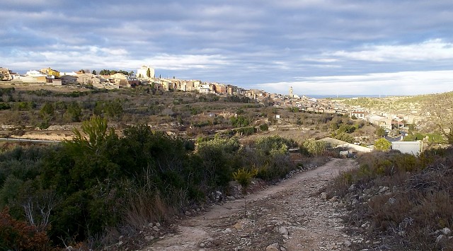
Village view
This shows most of our village, which is built on the side of a hill. It's not clear when the village dates from, most of the documentation having been burned or lost during the Civil War, but the following is taken from the Government website:-
The defensive tower of Arab origin which stood in the present-day location of the chapel of La Mare de Déu de la Misericòrdia, appears to have given its name to the town.
In 1153, Ramon Berenguer IV donated the land of the Mayoralty of Miravet to the Templars, and in 1228 a charter of settlement was granted. (there's a house in the village that is supposed to have belonged to the Commander of the Order of the Templars)
In 1317, with the extinction of the Order of the Templars, the Knights Hospitallers took over the jurisdiction
of this territory. (and a couple of the tracks leading to our Mas are named after them)
The town was walled until the 17th century, and now of the five entrance gates that completed the town's walls only one remains.
There's an old story that tells of criminals being sent to live in our village because it's out of the way and in times past would have been difficult to get to, so a bit like an inland Australia!
Go large to see it better.
Since I still have no hearing in my right ear I've been to the doctors this morning. He says I have to go to the specialist so that my ear can be better looked at... oh dear.
Comments
Sign in or get an account to comment.


