
Machen Corn Mill
I've lived in Machen Village since 1997, and only a few minutes walk away are some farm fields with what I assumed are disused farm buildings. For years, cows have been in the surrounding fields.
It struck me that I might get a blip photo, so off I set. On getting home, I looked to try and find the name of the farm. It appears it's called Machen Corn Mill, and has a history I had no clue about.
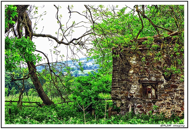
Most of it is overgrown, so my blip photo just shows part of one building being reclaimed by nature. In the background are part of the surrounding hills.
Machen Mill is named only as 'Melin' on the 1st edition of the 25-inch O. S. map (Monmouthshire Series), and as Machen Mill on the 2nd and 3rd editions of the Glamorganshire Series. Its function is not recorded on any of these maps, but it is assumed to have been a corn mill.
A weir on the Afon Rhymni directed water to the mill via a 170-metre leat, and the water then flowed via a 460-metre tailrace from which water could be directed to the Pandy some 500 metres to the south-east.
The corn mill's derelict buildings and mill house remain but have been used for other agricultural purposes. The route of the millrace to and from the river is traceable and parts of the culvert on the site can be seen. There is a primitive iron cauldron with brick chimney plus a winch and a vicious-looking crusher but no obvious mill machinery.
It's surprising what you learn when you go looking for photo's, sometimes right on your doorstep!
Comments
Sign in or get an account to comment.


