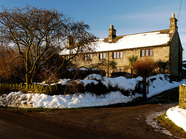
Upper Toad Hall
I've just lost my write-up for this image - more to follow!
I'd lost the tick (somehow) that keeps me signed into Blipfoto so when I put the computer down to I eat my evening meal it logged me out and I lost the lot. As I'm still not properly readjusted to UK time I couldn't rewrite it yesterday evening'.
The Story
There is still lots of snow about here (though it is melting where the sun is most intense) and the day was very cold. The late afternoon light was fantastic and I decided to make a detour on my walk to take the Toad Hall photographs - I've taken lots of photos of it as I've walked by in the past but never any in the snow.
There are lots of very interesting place and road names in our area and I often find myself speculating on their origins. We have Cold Bath Farm just down the road. Our road name is Hand Lane, which morphs into Dance Lane (possibly a corruption of Danes Lane) and then becomes Gudgeon Hole Lane. Toad Hall (as in the photograph) is one of my favourites. The UK was mapped by the Royal Board of Ordnance (Ordnance Survey) in the latter part of the Eighteenth Century and a detailed 6" map of the UK produced by the mid 1850's. I imagine the map-making surveyor asking about the name of the farm and a local in his broad South Yorkshire accent replying, `That's t'old hall'. At which point the surveyor writes down `Toad Hall' - perhaps there is another reason for the name - I must ask J what she thinks as she lives at Lower Toad Hall Farm.
Comments
Sign in or get an account to comment.


