Upstream
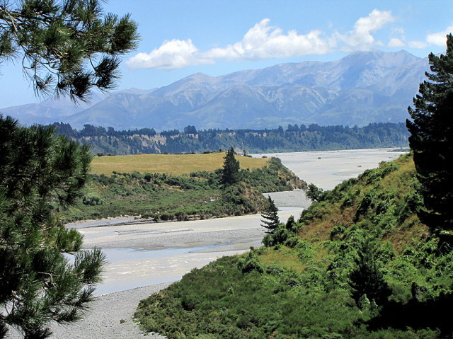
This afternoon I went to the Waimakariri Gorge to see if the river was flooded. It was muddy and swift, but the flood was past its peak. Last night a bridge downstream had to be closed.
Here is the view is upstream. Normally you'd see meandering blue ribbons where the expanse of pale grey water is. I was standing near the bridge at the eastern end of that bluff that crosses the picture just above mid-line. It sweeps in a curve around to the Gorge.
The mountains behind are the southern end of the Torlesse Range, except the peak obscured by the pine and the one next to it with the dot of snow. They belong to the Craigieburn Range.
The tree on the right-hand side is one of the pines that cast shadows across the water in my first blip.
Best seen large
Other views of the Gorge-
The Waimakariri Gorge bridge
Fishing, which was taken from the same spot as this shot
Comments
Sign in or get an account to comment.


