
I think I've broken my toe.
As a result of accidentally cracking it off a door frame yesterday. It's all black and blue and swollen. As a result I've not hobbled too far from my computer today.
I have been tasteful enough to spare you all a photo of the state of my toe though.
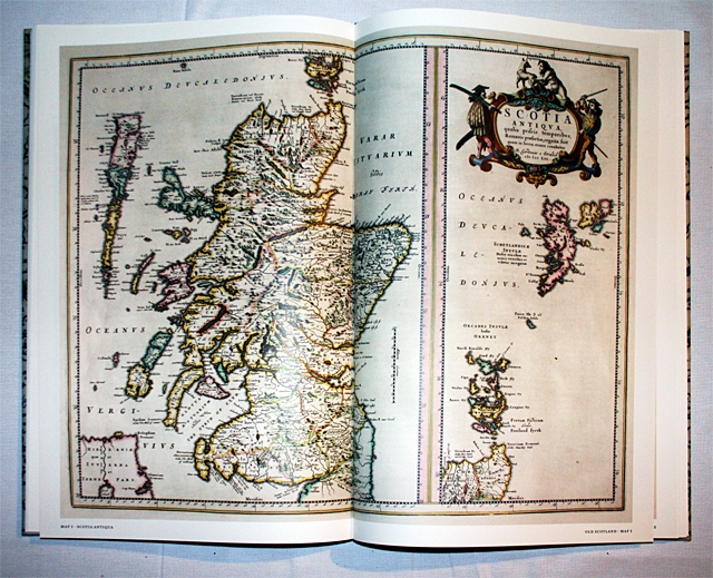
Instead you'll have to make do with one of the maps from Roz?s Christmas reading. It's the Blaeu's Atlas of Scotland, and Roz is delighted with it, probably more so than her significantly more expensive camera (not that the Atlas was cheap).
Joan Blaeu was a Dutch mapmaker and publisher who worked extensively for the Dutch East India Company during the 17th century. In 1654 he published this Atlas which was a collection of maps originally drawn by Timothy Pont and subsequently updated by Robert Gordon. It was apparently the culmination of 70 years work and at the time made Scotland one of the best mapped countries in the world. I believe that the mapmakers intended it to be published in Scotland but the project was, according to the words of Robert Gordon "Defeated by the avarice of printers and booksellers".
We first heard of it when we went to the open day on the Archaeological dig at Eldbottle between North Berwick and Aberlady. Apparently there was a golf course being built and the dig was started due to the fact the Archaeologists knew the village should be about there from Blaeu's Atlas.
This new printing of it includes translations of the accompanying text, a history and description of how the original came about, full prints of all 49 maps and details of many of them. If you're interested and you have the cash I'd recommend it. It can be bought at the birlinn website or cheaper at Amazon.
At 11.7 x 16.1 inches and 300 pages it isn't exactly light reading though.
Comments
Sign in or get an account to comment.


