
Second Severn Crossing
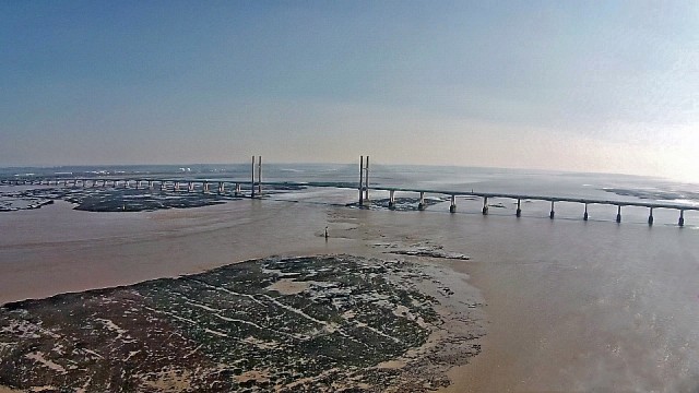
The blip photo is an aerial view taken from Sudbrook village, near Caldicot on the Welsh side of the bridge that crosses between Wales and England and is part of the M4 that links the capitol of Wales (Cardiff) to the capitol of England (London). The two countries are partly divided by Severn Estuary, and previous to the bridges it was a long detour through Gloucester which added hours to the journey between the two capitols.
It is difficult to get the whole length of the bridge in one picture as it's total span is 3.18 miles! However, I've got a fair bit in the picture.
Construction of the bridge started on 26 April 1992 and it opened on 5 June 1996. It is 114 feet wide and the towers are 449 feet high.
It's location is more south than the Severn Bridge and carries more traffic, which separates at Magor, on the M4 depending on which bridge is chosen. It has three lanes and a narrow hard shoulder each way, compared to the two lanes, cycle path and footpath of the original crossing. The path taken by the bridge is close to that of the Severn Tunnel which has carried the railway line beneath the river bed since 1886.
I have blipped an aerial of the original bridge, Severn Bridge here if you want to have a look.
Comments
Sign in or get an account to comment.


