Sully Island
My brother, David, had sold his Volvo estate car and needed a lift from Sully, near Cardiff, back home to Abergavenny. His girlfriend was having a bit of a party with colleagues she used to work with a few months ago, prior to accepting redundancy, so wasn't able to help.
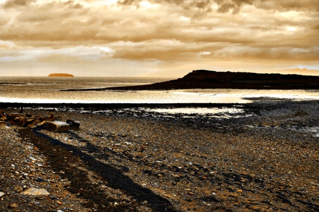
I arrived a Sully about an hour before meeting up with him to have a hunt for a blip photo. The blip photo is taken of Sully Island with Steep Holme Island in the background, on the Bristol Channel.
The island's name may mean "south lea" or "south pasture" or, like the nearby village of Sully it may be called after the Norman baronial family of Sir Reginald de Sully. The rate of tidal rise and fall in the area is the second highest in the world: only that of Bay of Fundy, Novia Scotia is greater. A rocky causeway connecting the island to the mainland is uncovered for approximately 3 hours either side of low tide, the island being cut off from the mainland for the rest of the day. This makes Sully Island a potentially dangerous place, and many people have been swept to their deaths while trying to leave the island as the tide rises very rapidly. All visitors to the island must exercise care and due diligence. Although now there is a timer near the island which gives visitors tidal times, letting them know if it's safe to cross.
There is evidence that the island was frequently visited by both Romans and Vikings and there is archealogical evidence for remains of a Saxon multivallate promontory fort occupying the eastern end of the Island, on the summit of which is a Bronze Age barrow. It has been suggested by some that this was an armed stronghold, but it was more likely to have been a defended residence and farm homestead.
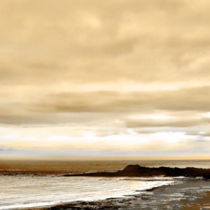
The extra photo is taken from the same spot looking towards Cardiff airport. Both are taken with photo filters.
Comments
Sign in or get an account to comment.


