
Haweswater Resevoir
Day 3 and we woke to glorious sunshine. Gail suggested a trip to Haweswater Reservoir, so we took her advice and headed over there after breakfast.
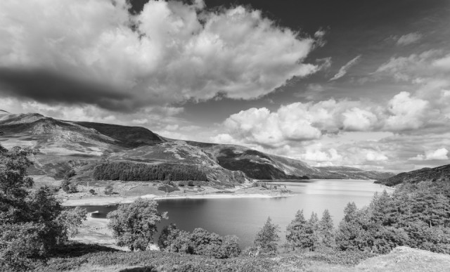
Haweswater was once a lake, but an Act passed by Parliament allowed the Manchester Corporation to build a dam in 1929 to supply water to the north-west of England. The dam, 470 metres long and 27.5 metres high, raised the water level by 29 metres, increasing the overall size of the reservoir significantly. There was public outcry as the farming villages of Measand and Mardale Green were lost when the valley was flooded in 1935. Before the valley was flooded the farms, dwellings, church and the centuries-old Dun Bull Inn were demolished and the population relocated. When the water level is very low, the remains of stone walls and the village bridge can still be seen.
We stopped off in a lay-by for a view looking south down the reservoir (as can be seen in the extra) and then headed to the carpark at the southern end of the reservoir. From here we climbed the hill, where this blip was taken, for far reaching views looking north.
Another stop off for hot chocolate and cake (has to be done on holiday), then we drove over to Watermillock to photograph the series of cascades of Aira Beck and Aira Force waterfall.
Dinner this evening was in the Coledale Inn in Braithwaite with the obligatory drinks to wash it all down!
Comments
Sign in or get an account to comment.


