
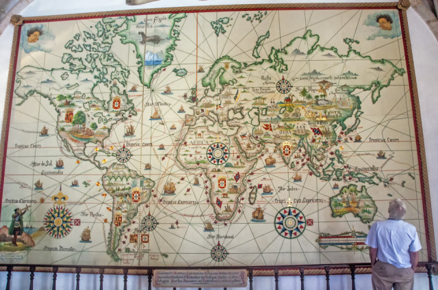
The world and its division into two spheres ....
Map at the entrance of the maritime museum in Belem/Lisbon(,Museu de Marinha), the vertical line going past N-America and through Brazil is the division 3 consecutive popes made in the late 15th, early 16th Century to pacify their two main Catholic countries/ royal houses Spain and Portugal in the age of conquering the unknown worldly territories. Everything West of the line was for Spain to explore and everything East of the line was for Portugal. See more about this papal decision here.
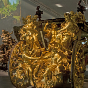
We visited the Museum of Carriages (Museu dos Coches) and the Maritime museum ( Museu de Marinha) today. Both well worth a visit, very interesting to see the extensive collection of official state/royal carriages, see an example of a very elaborately decorated one in the extras, that one was used for a triumphal parade when Lisbon was declared the capital of the Portuguese reign and certainly interesting to see the vast collection of maritime maps, globes, instruments, mock-ups etc of Portugal's naval history.
I'm totally knackered after all this (5 museums in three days and a lot of walking, plus sitting on buses :-) ) so please excuse me as I'm delaying the Abstract Thursday results until tomorrow
Thanks so much for your kind comments and stars for yesterday's doll house Blip, especially since I'm hardly able to comment myself at the moment
Comments
Sign in or get an account to comment.


