Storch Bridge
River Petterill (5)
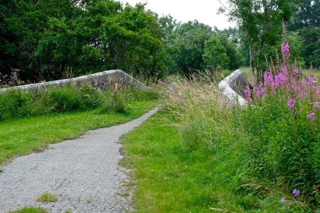
This is Storch Bridge, near Greystoke. It used to carry traffic over the River Petterill, but it was bypassed in 1939. Since then it has become a bit overgrown, and it is now only a pathway, not used by traffic at all. It was a nice little sandstone bridge in its day, as can be seen (sort of) in the Extra picture. It is Listed and has an important historical cast iron plate on the Boundary Stone, which marks the limits of the two parishes – Dacre and Greystoke. This photo was taken whilst standing on the New Storch Bridge, which takes the current Penrith to Greystoke road over the Petterill, seen in the foreground.
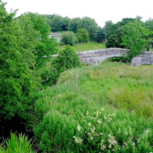
A few more pictures, if you are interested, but don’t feel obliged to look at them, as they are only there for my record. The Boundary Plate, - the Petterill taken from the new bridge, - information on the building of the new bridge, - the New Storch Bridge from Storch Bridge.
I have no idea about the name of the bridge. Storch is German for Stork and is also used as a German surname, but whether this is significant I don’t know. I would love it if someone did know why it has this name.
*************
We have moved on quite a bit from my last entry, as I gave up trying to get to the river as it passed by Greystoke, after my experiences with footpaths around there. Just before the Petterill arrived at this bridge it was joined by Summerground Gill, also known as the North Petterill. This is another source of the Petterill, rising from the high ground to the west of Greystoke. I thought that the route of this Gill through Greystoke could be a fascinating story in its own right, so decided to leave it for the moment. I would need a lot of help from Jerra and clickychick anyway, as this is their stomping ground.
Comments
Sign in or get an account to comment.


