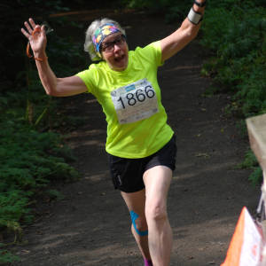
Solo Ascent of Geal Charn
I decided today I would attempt to summit Geal Charn (920m), otherwise known as the big hill behind Lagganlia. This would be a solo, first attempt, without oxygen walking poles, of a previously unclimbed mountain (well apart from Zoe who ran up it yesterday and the half dozen junior coaches who ran up it last year and waved to us from the top!)
As with all great expeditions, it is all in the planning. So, first thing this morning I checked my boots for forest debris and dug out a clean pair of socks. I chose a matching buff for my t-short and Into my rucksack went my waterproofs; my cameras (of course); compass; first aid kit; water bottle and essential carefully chosen protein/carb balanced expedition rations – my left over biscuit from the wildlife café yesterday and bag of Wendy mixed grazing (pecans, dark cherries, raisins and choccy buttons).
I consulted with TC, my expedition supervisor, who noted my route and looked a little sceptical if I’m honest (!) and Chief Sherpa Zoe who had recced the course for me yesterday. Her advice, when the path runs out, hack across the bilberry and heather to the open fell and the summit path should be clear ahead.
On this expedition I would be aided technologically by my extremely expensive GPS system, Map my Walk and so, sun hat donned, I strode out of Lagganlia heading towards Inshriach Forest.
The first part of the trek, 2.5 miles of gradual ascent through Inshriach, went without hitch. The forest track came to a halt and a smaller path led off in to the trees and turned uphill as Sherpa Zoe had predicted. Consulting the map, the contours were now much closer together and, recalling the words of my Geography teacher Cheyenne, and my orienteering prowess(!) I knew this meant steepness! I began to worry about acclimatisation at this point, but yesterday’s walk up the road to the Wildlife Park had stood me in good stead.
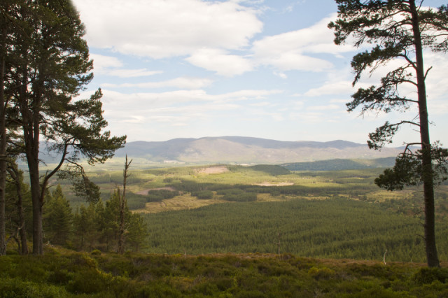
There was not a soul about as I headed upwards through the ever thinning trees. The path eventually turned into a narrow break in the heather and eventually stopped altogether. Following Zoe’s instructions I hacked across the undergrowth to the open hillside but found no evidence of the summit path. I stopped to consult the map and to enjoy the view across Speyside, and was immediately set upon by all things crawly and buzzy and airborne.
What followed was some aimless wandering along what were more likely deer tracks than proper paths till something bit me quite hard on the ankle and I decided to call it a day. Even the likes of Fiennes, Shackleton and Bonnington knew when to turn back! Before I was nibbled to death I took on sustenance and set about rediscovering the ‘path’ downhill. Map My Walk tells me I reached Camp 2 at 1750 feet.
Not the most successful expedition but a great walk out in this beautiful countryside. My blip is of the view across Inshriach and the Spey Valley from the top of, half way up Geal Charn!
Comments
Sign in or get an account to comment.


