
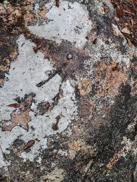
OSBM
This is an Ordnance Survey Bench Mark. An official listing exists for the level of the little brass stud in the image.
Surveyors are no longer guided to use OSBMs or trig points. They are regarded as legacy control points and we are instead directed to reconcile our own GPS/SV observations against concurrent data using the OS GPS National Network. Howver, when we come across one near to our survey site it is always interesting to do a double check against it.
Any closing errors need to be rergarded in context. I would always weight a calculation in favour of the modern technology solution and this particular marker was previously checked by the OS in 1953
Comments
Sign in or get an account to comment.


