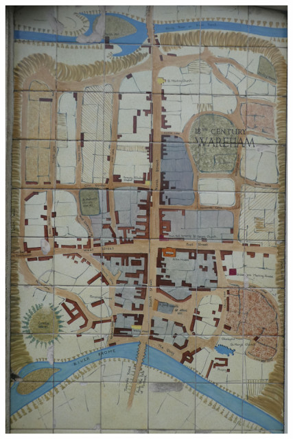
tiled map of Wareham in the 18th century
This is on a wall in Wareham Quay, presumably a copy of an old map.
The details are well worth looking at, particularly the fact that there were toll gates at each of the three entrances (North, West and South Streets) to the old town. East Street leads to the edge of Poole Harbour.
Much of Wareham was burned down in the middle 18th century; my guess is that the darker grey shading on the central area of the map indicates the area which was destroyed.
To enlarge the map, press Control + [plus] several times as required, control - [minus] restores its original size
162
views
- 2
- 0
- Panasonic DMC-TZ80
- 1/125
- f/3.7
- 6mm
- 80
Comments
Sign in or get an account to comment.


