Walking through time
Our walk between West Linton and Garvald along a moorland track took us along an old prehistoric route with remains of Neolithic burial cairns dating from over 4000 years old. Most of them are basically a pile of stones largely covered with vegetation but remains have been found of food bowls, a bronze awl, a sword and the earliest evidence of lead in Britain with a strand of lead beads. The Nether Cairn (extra) is now about 3.7 m high and 15m in diameter and appears to have been surrounded by a ditch.
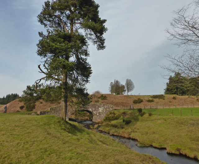
Going forward over 2000 years in time, part of our path back to West Linton followed the old Roman route between the garrisons at Biggar and Elginhaugh at Dalkeith. Subsequently the track also became the main route between northwest England, Biggar and Edinburgh and used until the A702 was built. Now virtually the only traffic crossing the South Slipperfield bridge which was built in 1620 is that of walkers.
The start of our walk had been along the route which became part of one of the most important drove roads between the Highlands and England. Until the advent of the railway, cattle which had been bought at the large Falkirk Tryst market were walked south because Scottish beef was very popular in England. Similarly sheep were taken north to Falkirk with their drovers sleeping on the path beside them at night. The very strong wind today was a reminder of how bad it could be at times on the exposed wet boggy moorland especially with the danger of robbers stealing their sheep or cattle at night.
The final short stretch was along a tarmac road bringing us back to the modern times and thankful that we reached home before it began to rain.

Comments
Sign in or get an account to comment.


