
Midland wall
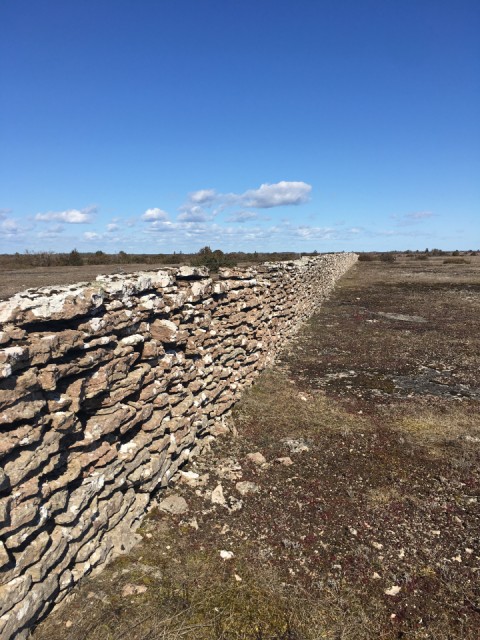
I was invited to join a facebook group called the wanderer group. It's mostly friends of mine, asking for company if you want to do a walk along one of the many paths on Öland. Alvaret is the name of a nature type where the soil are not more than two centimetres thick. Under that is red limestone, often "layered" rock, easy to use for building houses or walls.
Today seven of us followed a seven kilometer long path where we could see highly specialised plants growing here but also one of few wells, where we had our coffee, and one of several man built stone walls. This particular wall is about 1.5 m high and 50 cm wide. Each building block is, very ruffly, 30x50x10 cm and the wall is 40 km long, forming a perfectly straight line separating the island in two ruffly equal parts. You can perhaps find it via these coordinates: 56°30'44.5"N 16°31'14.2"E. You have to zoom in quite a bit to see it in satellite settings in Google maps, where it runs north/south.
This is only one of many stone walls on the island, laid in the beginning of the 19 century when the king decided the land was going to be split in a new way. I'm not yet familiar with the details. Most likely this was another burden laid on the poor farmers and I'm pretty sure there were horrible penalties if it wasn't straight or had the wrong measures. One looks at this wall with both sadness and great respect for the people who wore themselves out building it, while they still had to work very hard to feed a family on these barren lands with hardly any soil.
Comments
Sign in or get an account to comment.


