
Wildfires in Oregon
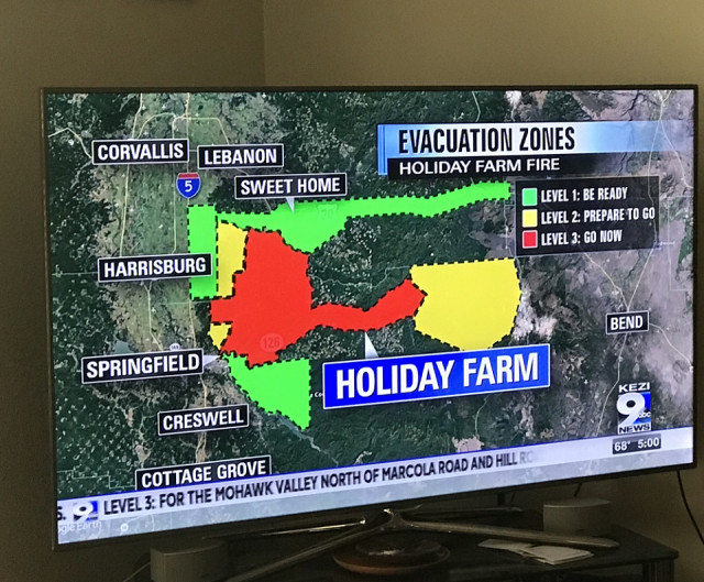
The Holiday Farm Fire is closest to us in Eugene. This map shows the stages of the evacuation areas. Eugene is under the “D” in the label of Springfield on the map. There is a river and a 6 lane freeway in between Springfield and Eugene. The distance from the edge of the evacuation plan to our house in Eugene is 15 miles. Feeling fairly safe from the fire. The smoke and ash is a different matter.
Comments
Sign in or get an account to comment.


