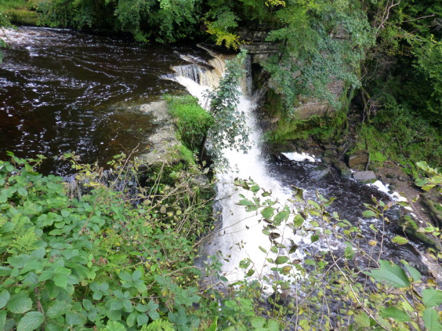
Lynn Spout
This is the highest of a series of falls along the Caaf Water in Lynn Glen, just south of Dalry. There is no formal track down the 30-odd feet to water level for the best view and, the terrain being muddy, I resisted the temptation and this is the view from the path.
The information panel informs us that The gorge of Lynn Glen was, in 1972, designated as a Site of Special Scientific Interest (SSSI) because of the unique and interesting rocks it contains. During the Carboniferous Period, 359-299 million years ago, the area that Lynn Glen is located was within an area that geologists call the Midland Valley. At that time Scotland was located on the equator with a tropical climate and the Midland Valley area was covered in rainforest. The surrounding tropical seas had an abundance of marine fauna including shellfish, corals and early fish.
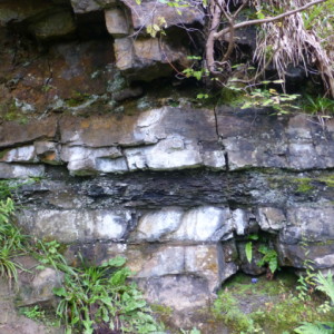
Sea level change caused by alternating periods of climate warming and cooling meant that the area was periodically inundated with sea water and then reverted back to swamp land. This resulted in the different stratigraphic layers with limestone and sandstone created from the sediments and corals of the nearshore shallow marine environments and the swamp lands producing shales and coal layers.
The limestone contains an abundant fauna of taxonomic and palaeoecological interest including corals, bivalves and sponges.
The extra photo shows the dark shale band separating the limestone, then sandstone (above) and limestone (below) layers. It was fun to guddle in the shallows upstream looking for fossils but no major discoveries were made.
Comments
Sign in or get an account to comment.


