Changing sides
No, not that, excellent news though it is. Something more mundane.
Last week end I blipped a we did a walk next to the stream 'Arroyo de la Ñora' which marks the eastern limit of the Gijón municipality. Today we went for a walk on the 'Campa Torres' headland, next to the river estuary 'Ria de Aboño' which marks the western limit. Those two points mark the extent of our latitudinal freedom for the time being. To the north the sea and not much to the south.
The east end is tranquil and semi-rural, complete with golf course. The west end is the gritty end.
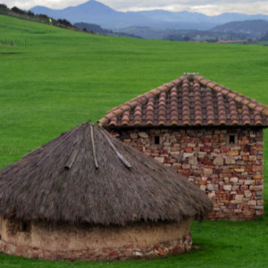
In pre-roman times the headland was a settlement, complete with defensive walls. It continued into Roman times, with a change of architecture from round wattle, daub and thatch to square stone and tiles (extra). It was superseded by Gijón itself down below.
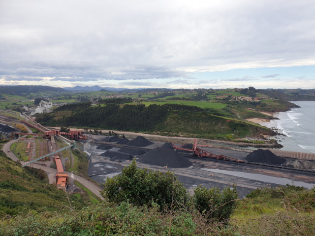
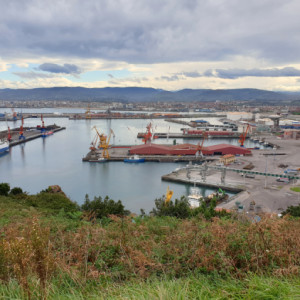
Nowadays it is surrounded by Gijón's industrial port on one side, cement and steel works on the other and a bunch of butane gasometers on top of it. Just a little further west along the coast it becomes green and pleasant again, but for now that's beyond our reach.
Comments
Sign in or get an account to comment.


