Ushakov ice cap
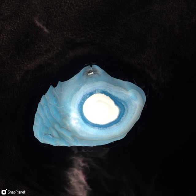
I spotted a picture of this on Twitter and thought I would have a closer look. It is a satellite image of the Ushakov ice cap, a small island in the Russian Arctic. I processed it from the ESA sentinel2 satellite using the snapplanet app (A free mobile app that gives access to the worldwide archive of sentinel 2 imagery).
The white is the last of the previous winter snow, dark blue is probably superimposed ice (meltwater that percolated through the winter snow + refroze on the underlying glacier ice before the snow then melted), paler blue is the compressed glacier ice with the stripes most likely annual layers of glacier ice, with the brownish tinges probably dust. The wiggliness of the blue stripes show how the ice deforms as it flows over the rock below.
I processed it using a near infrared filter that makes the Blues more vibrant because it picks out liquid water in the ice matrix.
Today has been a pretty normal day at work and home, nothing really exciting to report so messing about on snapplanet.io to make a blip seemed like a fun mini-project. The world is an incredibly beautiful place and it blows my mind quite literally that I can "create" these beautiful pictures '*on my phone* , in just a few minutes. It shows how both satellite imagery and processing power have increased in the last few years. And Thank You ESA for making all the sentinel data fully free and open...
Comments
Sign in or get an account to comment.


