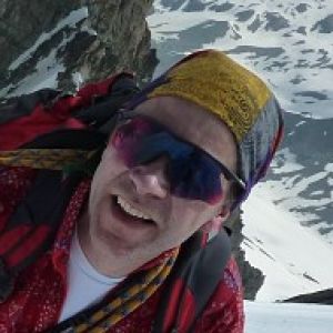
Summit of Maol Chean-Dearg
08:00 - the rain lashed against the window panes - Zzzz!
09:00 - we got up reluctantly and checked the weather forecast - it may improve after midday ... Oh Yeah???
10:00 - breakfast while looking up the valley with the forlorn hope that we might see a mountain
11:00 - rucksacks packed up, crampons, ice axes, sandwiches & tea made - can we go now? The rain lashes against the windows.
12:00 - A short break in the rain with the mountain tops teasing us in the clouds... another shower, but it does look a bit nicer. At least the wind seems to have died a bit.
12:30 - Shower passes over and we're off. Aching muscles from the previous day, but we hope we might at least make it to the pass.
Up the valley, over a footbridge across a raging torrent, waded a smaller side burn (sounds like Wiggo's been 'ere). Then up to a very posh bothy - the weather by now had cleared and we sat in the sun and soaked in the warmth. Now somewhat encouraged we walked further up the text book u-shaped valley. The vertical sandstone crags of Sgurr Ruadh on our right were picked out by shelves of snow. That was where we should have topped out from the other side on the previous day. Beyond the valley end to the north was a perfect white pyramid - the peak of Liathach taunting us from Torridon.
Then left and up the valley side 1500' to the top of the pass. It was a steep haul on tired legs but the scenery suddenly changed at the top. The bealach was a three-way junction between Maol Chean-Dearg, Sgorr Ruadh - an impressive rock stack of torridonian sandstone and the flat-topped bulk of Fuar Tholl. Lunchtime in the sun by the high lochan. Now with the weather holding and the top only a further 1000' above us we had to press on up a steep crumbly quartzite band followed by a flank of shattered sandstone teeth all gradually getting snowier as we ascended.
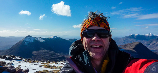
Then a stunning view opened up to a full 360º as we approached the summit cairn. A gentle breeze and a view that could fill a month of blips and not get boring.
This shot points north at the main ranges of Torridon. Loch Torridon and Beinn Alligin on my left with it's horns, Loch Kishorn and Beinn Damh over my right shoulder with Raasay and Skye in the sea on the horizon. Just visible beyond, but not seen on this picture was the Hebridean Isle of Lewis. On the other side we could see the Fannaichs, Ben Wyvis at the other end of the Great Glen and StrathFarrar hills to our south.
Phew - we were pretty sore when we got to the bottom. The whole round being some 16km, but it was worth every bit. Unfortunately every single picture I took just seems to come up short.
Comments
Sign in or get an account to comment.


