
A day along the Ohio and Erie Canal
The Ohio and Erie Canal was constructed in the early 1800s and connected Cleveland on Lake Erie with the Ohio River near Portsmouth in Scioto County.
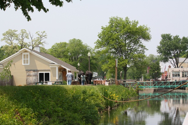
The canals enjoyed their heyday between 1830 and the 1860s. After that freight traffic rapidly diminished due to the construction of railroads. Canals in Ohio were difficult to maintain due to freezing in the winter and damage from floods. It was flooding which finally dealt the death blow to the remaining sections of the canal in March 1913, when, after a record winter snowfall storms dumped an abnormally heavy amount of rain on the state, causing extensive state-wide flooding. This caused the reservoirs to spill over into the canals, destroying aqueducts, washing out banks, and devastating most of the locks. Much of the towpath in the northern part of the state is being reclaimed for use as a recreational trail, which will ultimately extend for 100 miles from Dover (just north of New Philadelphia) to Lake Erie in Cleveland. Most of the canal itself is now at least partly filled in with vegetation, but there are a few places where it still contains water, and one of these is Canal Fulton, an old canal town, about thirty miles north from where we were camping. Here you can take a ride on a replica of one of the old canal boats, and travel for a few miles south along the canal, pulled by horses. In Canal Fulton, there is a visitor center where we watched a video presentation on the construction and heyday of the canal. Then we took the boat trip, had a picnic lunch, then went biking north on the towpath trail for about 16 miles return. The photo is taken from the boat as we were returning to the visitor center in Canal Fulton.
One year ago: Cedar Falls
Comments
Sign in or get an account to comment.


