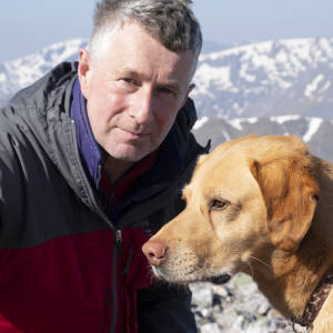
The Original Wee Minister
I could write a lot about this image and before I continue my inclusion in this image is a complete accident. Our visit to this part of the site was brief, the light was changing all the time, so I set up the timer to take a shot every two minutes as we took the measurements.
I am standing on a circular concrete plinth which is the position of the original Wee Minister statue. To save on surplus blip paragraphs I have elaborated on the story (as it was related to me by a long retired local game keeper) in another blog I add to now and then.
Lairig
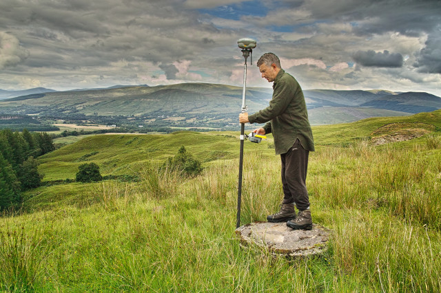
I am standing on the lower slopes of Cruach Innis (Inch) pretty much in the low centre of last night's blip.
The brick shape black cloud top right is hovering directly above Beinn Iaruinn the hill Caley and I were up on Saturday -without a memory card- and if I wasn't standing right in the way you would see our house in the distance from here too. I know that's all very parochial stuff.
In connection with this project I have been given sight of a 1934 ICE book about Survey Work on the Lochaber Water Power Scheme. It describes in detail the meticulous care with which a base line was measured along a railway line at Fort William, from which all the later theodolite triangulation would be established along the Glen Spean Valley. Micrometer or vernier read theodolites were used and thousands of sets of data would be taken early morning or late at night to minimise the refracting effect of the day time mountain air. Long predating computers huge brain bursting calculations were carried out using seven figure logarithm tables. In this scene here I am taking measurements in relation to the GPS base station (set up conveniently in my front garden today). A push of a button takes a measurement of about 3km in a couple of seconds to an accuracy of about 20 mm. It accounts for difference in height (170m here) and Earth curvature and the brain has not burnt a single calorie in doing it. While modern theodolites are now electronic with co-axial distance measurement built in, the techniques the 1920s engineers used are still adopted for precise work on the modern counterparts.
I have not read the book cover to cover but it is written with remarkable honesty and they have described techniques used (underground) some of which worked well, others which must have caused a lot of swearing as they were prone to going wrong and susceptible to damage as rock excavation went on.
Dimensional control to this day remains a tricky operation because the very area that needs careful measurement is the same zone which will be travelled by diggers, dumpers and people. The trick is for the engineer to be able to re-establish points quickly when the opportunity is presented. The underground surveyors had to jump in quickly on a Sunday morning as the dust and smoke was still settling from the last shift on Saturday night often to find that key marks had been buried or destroyed in the previous week's toil.
I have total respect for their ingenuity and professionalism
Comments
Sign in or get an account to comment.


