
Sauvie Island
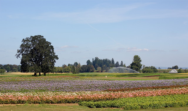
We did our Sauvie Island trip today. We got peaches! It is nearing the end of the season for them so we were glad we decided to get them. I could have blipped peaches or the trees, but you all know what that looks like. I'd rather show you a bit of the lovely island scenery. And of course, it's not about the peaches, it's about visiting Sauvie Island. All of the photos can be seen in this Flickr set. It begins and ends with the lovely St. John's Bridge, as we were on the other side of the river from the Cathedral Park shot I did awhile back. We were there in mid day, so the light isn't wonderful, but I take what I can get. I was in the back seat so I could move from side to side to try to get photos. The narrow roads have few places where you can stop as, typical it seems of these country roads, there is no shoulder for cars, only ditches. We did find a cafe/bait shop kind of place and had a snack. I have no idea why I didn't take a photo of the outside of the place. I did take a photo of the map of the island which was on their inside wall. Bill was a good sport, dragging the two old ladies around, and he is napping now. Poor baby.
Here is more than you probably want to know about this island, which has some interesting history, not all of it in these few paragraphs.
Sauvie Island, in the U.S. state of Oregon, originally Wapato Island (named by Lewis and Clark) or Wappatoo Island, is the largest island along the Columbia River, at 26,000 acres (105 km²), and one of the largest river islands in the United States. It lies approximately ten miles northwest of downtown Portland, between the Columbia River to the east, the Multnomah Channel to the west, and the Willamette River to the south. Sturgeon Lake, in the north central part of the island, is the most prominent water feature. The land area is 84.82 km² (32.75 sq mi, or 20,959 acres), which is larger than Manhattan. Most of the island is in Multnomah County, but the northern third is in Columbia County. The Sauvie Island Bridge provides access across the Multnomah Channel from U.S. Route 30 and was completed in June, 2009, replacing the first bridge to connect the island to the mainland which was opened on 30 December 1950.
The island is predominantly farmland and wildlife refuge and is a popular place for picking pumpkins, hunting geese and kayaking. There were 1,078 year-round residents at the 2000 census. There is an industrial zone and small grocery store in the southeast corner, near the bridge. Bicyclists flock to the island because its flat topography and lengthy low-volume roads make it ideal for cycling. Its nearest incorporated neighbors are the Portland-Vancouver metropolitan area to its south and southeast; St. Helens across the Multnomah Channel from the extreme northern tip of the island; and Scappoose, across the Multnomah Channel to the west.
267
views
- 4
- 0
- Canon EOS REBEL T2i
- f/4.5
- 50mm
- 100
Comments
Sign in or get an account to comment.


