
Blipmeet
Bliper heanku, and her husband T has been visiting Öland for some days, as they often do because they both like the islands for different reasons. He is an ornithologist and loves the birdlife here and she use to say she loves watching him looking at birds. But they both like the vastness of Alvaret, the big plane and world heritage on the southern part of the island.
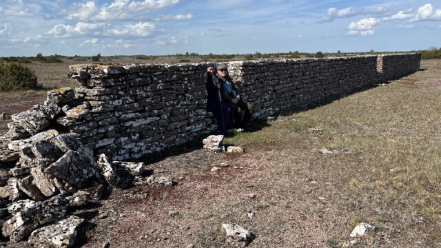
They asked me if I could suggest a trail we could walk together for a couple of hours. I suggested one that is called "Bårby källa" (Bårby well), a six km easy track but where one can see all the special geological features and many of the small plants growing here. Of course, the well is the perfect fika-place too. Also, we passed the huge 40km man made wall along the middle of Alvaret. Next to that wall is the "Mapmakers wall" a short wall built 1839 when it was decided that Öland was going to be measured properly. Then, they used a method called "Triangulation", read about it on Wikipedia. The wall was built as a starting point for the measurements and is the base line for the first triangle. Here they both are, sitting comfortably in the wall. This is a modern copy of it, built next to the old one in the 1940s, after the original one had collapsed
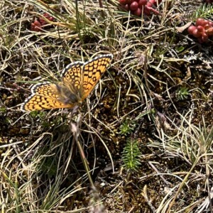
The first extra is a Melitaea cinxia, "Fältnätfjäril", Glanville fritillary butterfly in English. It was sitting still long enough for me to take a few fotos of it, which is most unusual.
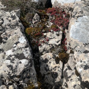
Second extra is about finding shelter that makes it easier to grow. All the plants out here, except for the juniper bush are minute and keeps close to the ground to survive the almost constant wind.
Comments
Sign in or get an account to comment.


