Almost the end!
This is the end of the journey of Andy Goldsworthy’s arch, although it is not quite the end of the story. For anyone who wants to catch up with the project, I will provide a full list of the blips when I post the last bit very soon.
Today, with all that heavy cloud gone and a lovely day promised, we set out to complete the arch’s journey. With the help of the OS map, we managed to discover the way that the Drove Road went from Lambrigg all the way down to Kirkby Lonsdale. The road is marked on the map as the Old Scots Road, so it wasn’t too difficult to find. It did take us along a lovely road we didn’t know existed.
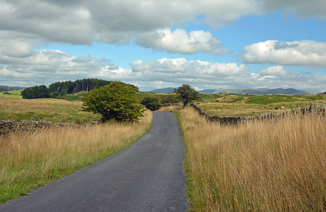
The drovers tended to keep to well-defined routes with which they were familiar and had facilities, such as good overnight pastures, inns and markets. These roads were usually wide (partly due to the effects of droving) with some grazing available on the road itself. They twist and turn to follow the lie of the land. So this picture (see it large) I thought was a good example of such a road. In the distance are the Howgill Fells, which were the ones under cloud yesterday.
Along this road we passed Three Mile House, a large house, which was originally a Drovers’ Inn. We went through Old Town, which is a small and very old village, but in droving times it had a large October cattle fair and was a popular stopping off point for the drovers.
We did find three sheepfolds, which were stopping places for the arch, along this bit of the drove road, but they were not easy to photograph because of all the undergrowth. Not the best time of year for finding things in fields!!
Here are pictures of two of the sheepfolds. The first one is at Wynhhammere, near Old Town. The next two are of one at Fellside, near Kirkby Lonsdale. (The third sheepfold today was so covered in undergrowth and was impossible to get to or even see!)
Comments
Sign in or get an account to comment.


