
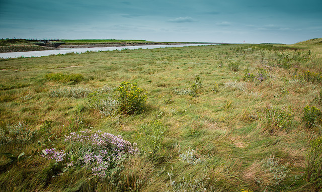
Mouth of the Nene
Today Pete and travelled to the Wash, parking near the mouth of the River Nene and walking east towards Norfolk in search of a rare plant that hadn't been recorded for many years. Sadly the area where it had formerly occured was no longer grazed and its location had been swamped by dense sea couch. I was pretty shattered at the end of our 7km walk - although the sea bank is flat there was a head wind on the way back, and the unvarying, though charismatic, landscape made it rather monotonous.
The Wash is an almost square shaped bay located off the coast of Lincolnshire and Norfolk. At fifteen miles long and covering an area of one hundred square miles, The Wash is the largest natural bay in England. The marine limits of the Wash are from Gibraltar Point in Lincolnshire at it's most northern point to Hunstanton in Norfolk at it's southern most point.
The Wash is fed by four large rivers, the sixty five mile long River Welland, the eighty two mile long River Witham, the ninety one mile long River Nene and the one hundred and forty three mile long River Great Ouse, which between them drain some of England's lowest lying terrain located in the fen lands of the counties of Cambridgeshire, Lincolnshire and Norfolk, before eventually making their way out into the North Sea.
The vast bay consists of salt marshes and extensive inter tidal mudflats which are interspersed with saline lagoons and extensive areas of quicksand. This area of saltmarsh is situated near the mouth of the river, and is still grazed by cattle, which means that it supports a diverse flora of salt-tolerant plants such as sea lavender, sea aster, sea purslane and purple seablite, many of which are succulent.
Comments
Sign in or get an account to comment.


