Let there be Light
Back blip of my trip down south
When we left Christchurch to make our way to Lake Tekapo at the start of our trip down south the wind had started to pick up but there wasn't much rain. A few hours after that Christchurch was flooded with the worst storm in a 100 years.. they said. Glad we missed it. Our house was Ok.
When we arrived at Lake Tekapo it was very windy and very cold.. just like a ice blast! But there wasn't any rain. We took a drive up the lake to visit Lake Alexandrina as I had never been there before. It was so cold there!
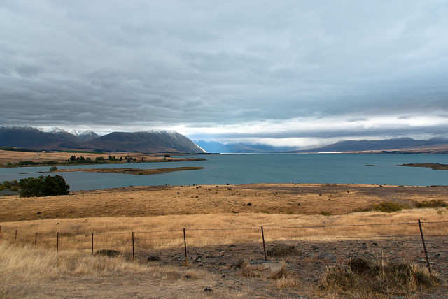
This shot was taken looking up Lake Tekapo. It is the second-largest of three roughly parallel lakes running north–south along the northern edge of the Mackenzie Basin in the South Island of New Zealand (the others are Lake Pukaki and Lake Ohau). It covers an area of 83 square kilometres (32 sq mi), and is at an altitude of 700 metres (2,300 ft) above sea level.
The lake is fed at its northern end by the braided Godley River, which has its source in the Southern Alps to the north. The lake is a popular tourist destination, and several resort hotels are located at the township of Lake Tekapo at the lake's southern end. The Lake Tekapo Regional Park, administered by Environment Canterbury, is located on the southern shore of the lake.
An astronomical observatory is located at Mount John, which is to the north of the town, and south of the small Lake Alexandrina. I wanted to see the Mount John observatory but the cloud was so low down we couldn't go up.
For more info on Lake Tekapo.
Comments
Sign in or get an account to comment.


