
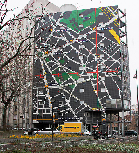
Large Lego Map--Paris
The title is of course tongue in cheek--the blocks constructing this marvelous map of our Paris neighborhood are on the side of a building. Fun to view large.
It's in Paris's 13th arrondissement, down the Rue Tolbiac from our rented apartment (off the map to the left), and 200 meters northeast of the Olympiad Metro station (which is new and thus not on the map--terminus of an automatic line). The building's location is marked on the map by the red crosshairs running vertically and horizontally.
Other Metro stations are clearly indicated with a yellow M--ours is Tolbiac, and the Rue Tolbiac extends from it to the right. Bus routes are indicated by thin black lines along the appropriate streets (e.g. the 62 Bus, which runs along Rue Tolbiac--and is indicated by the numeral 62 at the left edge of the map).
The Avenue d'Italie is the broad thoroughfare extending nearly straight down from the Place d'Italie. Chinatown is roughly above the yellow postal truck passing by (adding with the forsythias to the yellow color theme).
I actually discovered this for the first time yesterday afternoon, and would have blipped it then. But I already had shots of music on the Rue Mouffetard.
Comments
Sign in or get an account to comment.


