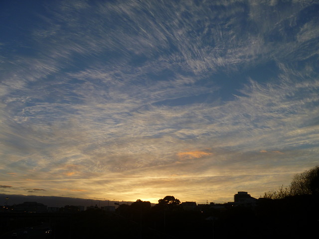
Cirrus at dawn
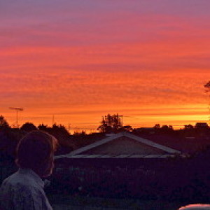
Staying in the city this weekend, and my run took me to the top of Maungawhau. On the way back I cross the North Western Motorway by a pedestrian bridge into Waima Street. This was the view I got looking to the east. Just before the sun came above the horizon.
I decided to do some reading about cirrus clouds, and this is what I found.
The name for these clouds derives from the Latin cirrus = curl of hair, tuft or wisp. Cirrus cloud is a member of the ten fundamental cloud types (or cloud genera) and are wispy white high-altitude cloud formations occurring between about 5 to 13km (16,600 to 40,000ft). They are the highest of the main cloud genera; popularly known as 'mares' tails they may even form in the upper troposphere.
They generally occur as thin featherlike white, silky patches or fine, narrow bands. Shaped by strong winds in the upper atmosphere they may be curved, hooked, fairly straight or randomly entangled. Although normally white, they may be grey when dense and seen against the light, and yellow, orange, pink, purple and reddish when illuminated by the low sun.
Cirrus are composed of minute ice crystals, in regions where air temperature is lower than -20°C or -30°C. They may be caused by turbulence and wind shear, or by upper-tropospheric convection. Sometimes they are just blown out ice-crystals spreading from the top of a dying cumulonimbus or dissolving altocumulus. Another method of cirrus formation is from the condensation trails of aircraft; one is seen here.
Cirrus are often an indication of the leading edge of a warm front at altitude, especially if they are spreading out from the west or south-west sector, thickening into a denser sheet of cirrostratus. The approaching depression is some 24 to 36 hours away. Jet stream cirrus are often indicating an depression or occlusion from the western sector, some 12 to 36 hours away. However, cirrus can also be true fair weather clouds. If they appear irregular and patchy, slowly shifting from easterly directions, often dissolving, they are indicating increasing high pressure and dry, sunny and quiet weather.
Comments
Sign in or get an account to comment.


