(Flood)plains, trains, and automobiles
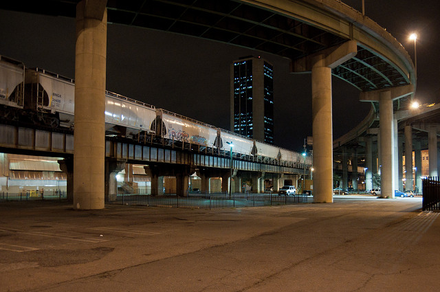
The Richmond-Petersburg Turnpike opened in July 1958 and was absorbed into Interstate 95 in August of the same year. I-95 is now the longest north-south interstate route in the United States. Virtually the entire route through Richmond is made up of bridges (11 bridges covering 7 miles of roadway). All 11 bridges are being rehabilitated over the next 4 years (YAY traffic nightmare!) so everyone is suddenly aware of just how much of this stretch is actually overhead.
I'll never understand what made them build an interstate over this route. Had they looked a mile or less to the east they could have avoided most of the historic neighborhoods (Navy Hill would possibly have survived) and they wouldn't have needed these enormous spans over Shockoe Bottom. Oh well, stepping down from my soapbox...
Shockoe Bottom once was the hub of all commerce activity in the city. As such, the railways all came through here. Most of these are also elevated--Shockoe Bottom happens to be a floodplain. If you are asking why anyone would have established a city in an area prone to flooding the answer is actually quite simple. This is the farthest upstream on the James River that boats are able to travel. The fall line creates significant elevation change, unnavigable rapids, and large rock formations in the water. All of which make for great watersports... and terrible transportation in the 18th century.
Good thing we got past that whole water-transportation thing and moved on to the highly navigable interstate system. Oh, wait...
123
views
- 0
- 0
- Nikon D90
- 1/13
- f/2.8
- 17mm
- 1600
Comments
Sign in or get an account to comment.


