
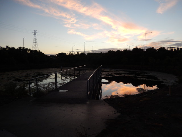
Onepoto Basin
This is the next in my series of volcano shots. It is an explosion crater with a high surrounding tuff ring. The name of the volcano is Te Kopua o Matakerepo, and this portion of the entire crater is the Onepoto Basin.
The pond was created relatively recently within the crater of the oldest volcano in the Auckland region. Based on fission track dates on basaltic rock obtained from beneath the lake sediment which had accumulated within the crater, Te Kopua o Matakerepo erupted about 250,000 years ago. At that time the sea level was lower than it is now, and mature Kauri forest grew here. Hollow moulds of some of the trees killed and buried by the ash from that explosion were uncovered when the southwestern portion of the tuff ring was removed in the 1950s to provide fill for the motorway approaches to the Harbour Bridge.
Before the explosion of Te Kopua, this was a shallow wooded tributary valley. The tuff ring from the volcano blocked the outflow, forming an extensive shallow lake. This gradually filled with silt and peat to form a large flat area, currently occupied by playing fields (to the left of this view). Tidal mud flats and a salt marsh were lost by reclamation to create the playing fields. In the process, this pond was created.
The photo shows part of the southeast portion of the tuff ring which separates this volcano from another volcanic tuff crater.
Comments
Sign in or get an account to comment.


