
All Mine
(I need to fill in a couple of days but I did post blips here and there.)
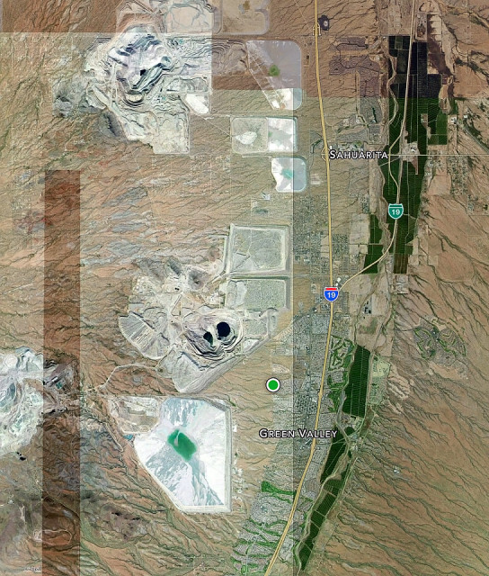
This is a satellite view of the area in which I live. The green dot on the left (west)side of I-19 is my house. All of those huge white patches - some kind of craggy and some kind of flat - are copper mines. As far as I know, the mine to my northwest is the largest copper mine in the state. The bare area to my west and south is desert. It used to be known as the West Desert Preserve. Then the mine bought the land so they could dig mitigating wells throughout the area to keep toxins (which we found out had started to leech into the ground) out of our drinking water. I used to walk back there and take photos (and step in cow pies). Now, it's called West Desert Trails. You need a permit to use it for recreational purposes (dirt biking, 4-wheeling, hiking, etc) and going on certain trails are prohibited (Maps are provided with your permit.)
You might notice that the majority of the housing is on either side of the highway. I'm on the fringe on the top of a hill. Those bright, dark green strips are pecan groves, the largest irrigated pecan groves in the world. Taking the old I-19 (the green 19 symbol) is a picturesque drive to Tucson because the gorgeous trees engulf the road.
I put the wider view as an extra, showing the southern and part of the eastern side of Tucson.
PS Arizona is known as the Copper State and has a copper colored star in the center of its state flag..

Comments
Sign in or get an account to comment.


