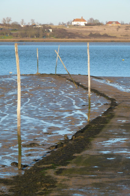
Site of Harty Ferry
Completed another section of our long standing ambition to walk around the coast of Kent from Dartford to Rye (which is just over the border in East Sussex). This section picks up from where we left off quite a few months ago at Conyer Creek (actually Tenyham railway station) around to Oare and then on to Faversham to catch the train back to the starting point.
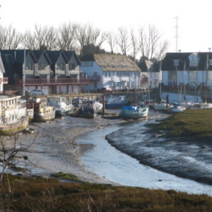
The route followed the Saxon Shore Way along Conyer Creek, then along the Swale til we reached Oare Creek. The North Kent has many shallow, winding creeks indenting the coastline all of which were flourishing trading ports in the 19th century transporting goods to and from London in magnificent Thames barges of which the Greta is one of the remaining examples. All that remains is the decaying evidence of these once busy days with sites of old brickworks, docks and moorings littering the coast. Today, the creeks are the haunt of leisure craft which are grounded on mudflats at low tide, many of which have seen better days.
It was a wonderful day. Weather was perfect, ground underfoot flat and mostly dry. The nine and a quarter miles just flew by as did loads of wading birds busy feeding in the exposed mud.We enjoyed our lunch on the side of the sea dyke in the warm facing the sun and a scone and tea back in Faversham.
There were many shots to choose from today, this one is of Harty Ferry, one of three ferries that used to move goods and people across the Swale from Oare on the mainland to the Isle of Sheppey. It was last used in 1946 and although there have been many attempts to revive the service none have come to fruition.
Completing this section means we have now walked from Swale to Ramsgate and then from Sandwich to Dungeness. What remains is to fill in the section between Ramsgate and Sandwich, Dungeness to Camber, Rainham to Swale, and the longer stretch along the Thames from Upnor to Dartford. (Zoom in on the map for all these places)


Comments
Sign in or get an account to comment.


