
Dead End
A few weeks ago, on a Ramblers walk through the Bantaskine Estate in Falkirk, I saw several new interpretation boards for a Battle of Falkirk Muir Trail. The Battle of Falkirk Muir took place between Jacobite and Hanoverian forces on 17 January 1746.
I thought this would make for a short, interesting Sunday afternoon walk, so I drove over to the car park at Greenhill and found another board with a map of several waymarked routes in the area. And so I headed off on the 'red route' around the Battle of Falkirk Muir Trail.
The board indicated it was 4km in length and would take around 45 minutes. Unfortunately, just short of half-way round, the path was blocked by a wire fence. Thankfully, there was a pavement on this stretch of the country road so I walked that for a short while before, hopefully, rejoining the waymarked route for the remaining 2.5km or so.
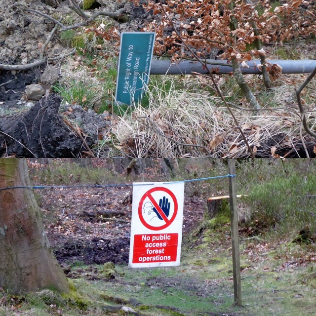
Sadly that idea also came to nothing as, at the next access point, there was a pile of gravel, a churned-up path, some rather impenetrable bushes, a torn-down "Right of Way" sign and a "No Public Access" sign. (I've come across quite a few of the latter over the last few weeks!)
Monday might see a wee email or two to the landowners (Callendar Estates) and ScotWays (the Scottish Rights of Way & Access Society).
Sometimes, walking does present its challenges!
Comments
Sign in or get an account to comment.


