
Bridge 129 - Old Site
This is a blip purely for documentary purposes as there is nothing of merit in the photo itself.
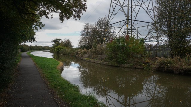
A couple of weeks ago I did a blip of Bridge 129 and commented about its history which intrigued me. I realised that the current bridge replaced an older one in the 1950s so today I went to see if I could find any evidence of the old one. As the photo shows I found the location where the canal narrows, which is obviously where the bridge was sited, but there was no other trace.
The OS map for 1952 shows a track running from the A540 across the canal to Blacon Hall. On the main road side (left hand side of my picture) there is now a fence and hedges hiding gardens but I could see an old cottage through a gap and it was possible to see where the track used to go. It became even more evident after looking at the satellite picture on Google maps.
On the other side of the canal there is now an electricity pylon and playing fields so no evidence at all.
I then decided to see if I could find out anything about Blacon Hall itself but information is virtually non-existent. As far as I can make out there was a hall in the area according to a map of 1577 but it was believed to have been destroyed along with surrounding cottages during the English Civil War between 1643 and 1645.
In an 1819 map the name Little Blacon appears on a site occupied by Blacon Hall on an 1831 map and this is the same one I see in the 1952 edition. I tried looking for images and the only one I could find was one from 1900 on the Chester Chronicle website Blacon Hall. The hall must have been demolished in the 1950s to make way for housing.
Anyway it has been fascinating looking into this and I will check out the numbering system again to see if I can discover any other sites of old canal bridges.
The write-up is much better than my picture today :)
Comments
Sign in or get an account to comment.


