
Hand drawn maps...
...by E. Thomas signed and dated by this person September 1833, and March 1834.
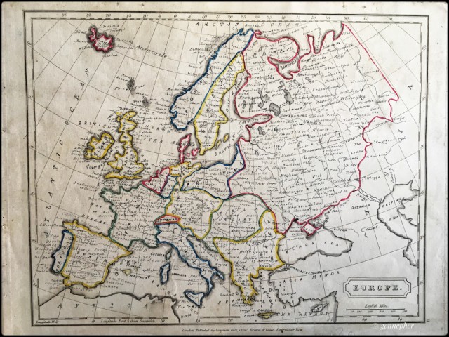
Europe was dated September 1833.
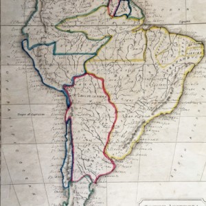
South America was dated March 1834.
The blank map pages were printed in 1822 by Longman, London. The other pages I have are:
United States
North America
Hindoostan
Africa
These pages have no maps drawn on them.
It looks like from the Roman numerals that there had been more pages.
So, the blank pages just have the black frame round the edge with the latitude and longitude on, and the middle has the latitude and longitude lines.
E. Thomas appears to have painstakingly, metriculously hand drawn Europe with a mapping pen, and then South America. And then hand written in the names of the countries, and then place names.
There is one heck of a lot of work here.
England is mentioned along with Scotland, but Wales does not appear to merit being named!
The only reason I found this today is I was looking for paper to gel print on...
But when I looked carefully I suddenly realised it had all been hand drawn!
Ooops!
So I shall enter it for admirer's SillySaturday challenge...because it is silly me going to use it to print on...and they were printed 199 years ago, nearly 200 years old.
Don't worry they have been reprieved...
I am looking at a first edition book now, 1937, printed in Austria which I am considering using for gel plate printing....
Maybe I had better research it first....(Update: another ooops silly me. I was thinking of using it for gel plate printing. I had only paid £1 for this art book many years ago, and it's worth over £50 according to online stuff...I kinda wished I hadn't looked now, I was going to happily use it for gel printing...)
Thank you for you comments and love.
Take care x
Comments
Sign in or get an account to comment.


