
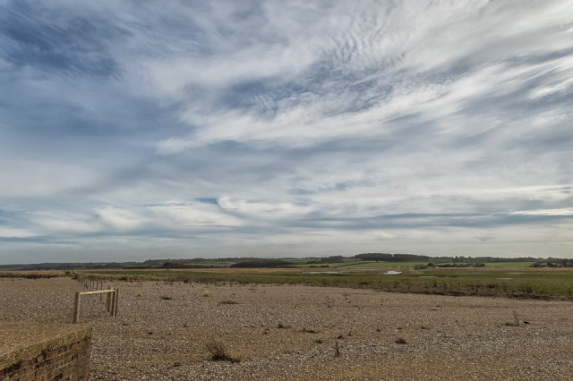
View Across the Marshes
I went to a workshop at Cley visitor centre today entitled Unraveling the Historical Landscape. The workshop leader took us through the origin and history of Cley marshes. We examined copies of maps dating back to 1586 and more recent google earth maps, and also identified key features on a walk through the landscape. There were some lovely clouds as we walked back from the shingle beach and I enjoyed watching a murmeration of starlings too (see Extras).
More info below if you're interested:
Cley next the Sea was once one of the busiest ports in England. The channels silted up around the time the salt marshes were enclosed and reclaimed using banks by wealthy landowners from as early as 1522. This work was often taken undertaken by Dutch engineers. There are raised areas in the marshes called Eyes which are thought to be glacial (or river) deposits. We also saw defensive structures from WWII including a pillbox and a gun turret dome and saw remnants of what was thought to an Italian prisoner of war camp.
I also spoke to the workshop leader about the decision to abandon sea defenses and the likelihood of the area returning to salt marshes. Unfortunately I think that might not be far away. I wonder if the coast road will be defended or abandoned as well. On a positive note, I read something the other day that said that salt marshes are excellent at soaking up and storing carbon.
Comments
Sign in or get an account to comment.


