
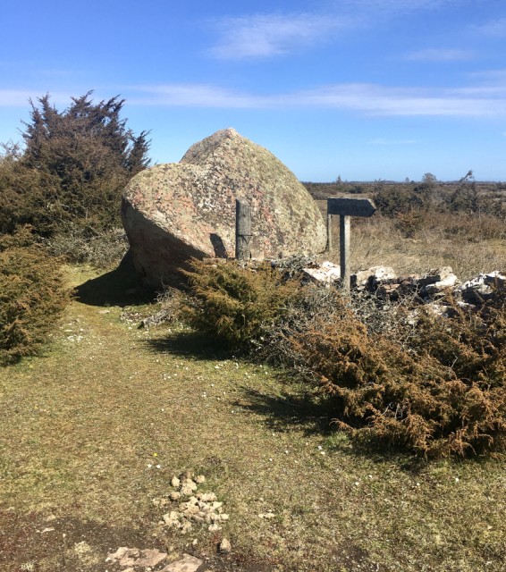
Middle rock
The Hike-group did another amazing walk today. We were only three on this trip, sad for the ones who couldn't make it. The nature on this hike is very varied, through forest, alvar, deserted village, old railroad embankment. The aim for the hike today was a huge rock, transported and dropped here by the ice during the last ice age.
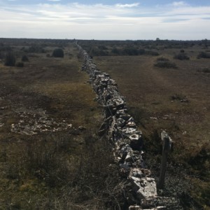
Somewhere during the eighteen hundreds the king decided to divide the crowns land. The peasants was ordered to build a system of stone walls, separating the parishes and also marking the village borders (there might have been other reasons too). The longest wall and the first to be built is the one running north/south called the midland wall, 40 km long. All the walls are built straight as a ruler, there are no curves. This huge rock, called the middle rock, is right in the middle of two parishes, one on the east side of the island, one on the west. The wall makes a sharp angle south exactly at the rock, they made the rock a part of the wall, as a well known land mark. The main shows the rock itself, about two and a half meter high at least and clearly visible on Google maps satellite images. The first extra shows the wall continuing its journey towards the south, photographed from the top of the rock.
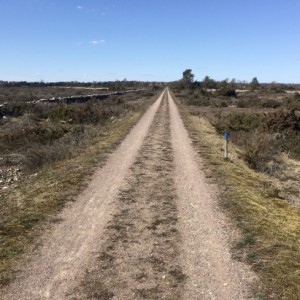
After the walk to the rock, and a coffee and sandwich brake, we had an equal stretch back to the car park. That path followed the bank of the old railroad for about two and a half km. The first railroad on the island was built in 1906 and over the years the island was covered by railroad north to south and a couple east-west. We followed the southern one, crossing the island. See second extra. In 1961 the railroad company stopped running the trains, it wasn't profitable anymore. Some of these railroad banks are now popular roads for bicycles and hikers.
Another lovely day out with friends. Today was 8,2 km long, good for the legs and soul. We're already planning the hike for next weekend.
Comments
Sign in or get an account to comment.


