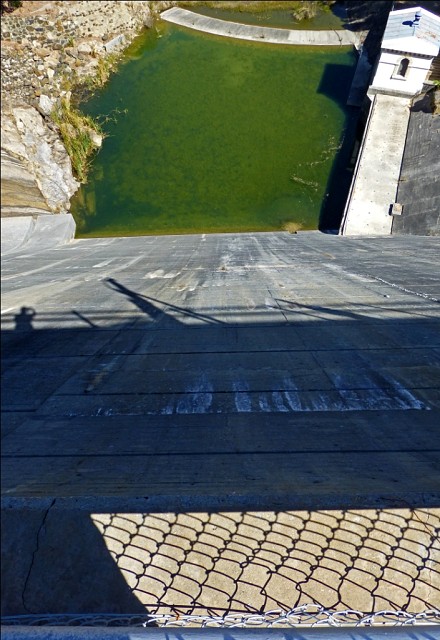
dam wall
42 m (138') in height this is from the top of dam wall of Mundaring Weir, looking down the Helena Valley.
The last time water poured over the top was in 1996 and spectacular a sight it was. Now the old railway tracks near the base of the wall, built to carry materials when the dam was built, are exposed and the water level is very, very low.
Constructed in the late 19th century, water from the dammed lake was carried by pipeline across 556kms of wild and rugged terrain to the newly discovered Goldfields of Western Australia, the hub of which was back then and still is, Kalgoorlie.
A truly amazing feat of construction, and today water from this dam still flows into Mt Charlotte Reservoir in 'Kal' and though the technology is no longer steam driven pumping stations, the 'Golden Pipeline' still delivers some of the Goldfields' lifeblood.
And yes that is my 'blipping' shadow!
Please excuse the possible lack of commenting for the next few days. A friend an I are heading to deepest, darkest Denmark (the WA variety!) and while I may hopefully upload a blip or two, time may restrict the comments.
170
views
- 0
- 0
- Panasonic DMC-TZ30
- f/4.0
- 4mm
- 100
Comments
Sign in or get an account to comment.


